| 1 |
胡德宝, 龚茂珣, 孔亚珍. 强风暴潮对上海地区影响研究. 华东师范大学学报(自然科学版), 2005, (5/6): 177- 182.
|
| 2 |
中华人民共和国自然资源部. 中国海洋灾害公报(1997—2003) [R/OL]. [2021-05-01]. http://www.mnr.gov.cn/sj/sjfw/hy/gbgg/zghyzhgb/.
|
| 3 |
王军, 黄海雷, 张呈, 等. 浅谈上海应对风暴潮灾害的措施. 海洋开发与管理, 2017, 34 (1): 92- 96.
doi: 10.3969/j.issn.1005-9857.2017.01.018
|
| 4 |
王璐阳, 张敏, 温家洪, 等. 上海复合极端风暴洪水淹没模拟. 水科学进展, 2019, 30 (4): 546- 555.
|
| 5 |
伍志元, 蒋昌波, 邓斌, 等. 基于海气耦合模式的南中国海北部风暴潮模拟. 科学通报, 2018, 63 (33): 3494- 3504.
|
| 6 |
孙志林, 王辰, 钟汕虹, 等. 浪潮耦合的舟山渔港台风暴潮数值模拟. 海洋通报, 2019, 38 (2): 150- 158.
|
| 7 |
李慧. 基于动态洪水演进模型的气候变化对沿海区影响研究. 水利水电快报, 2019, 40 (4): 4.
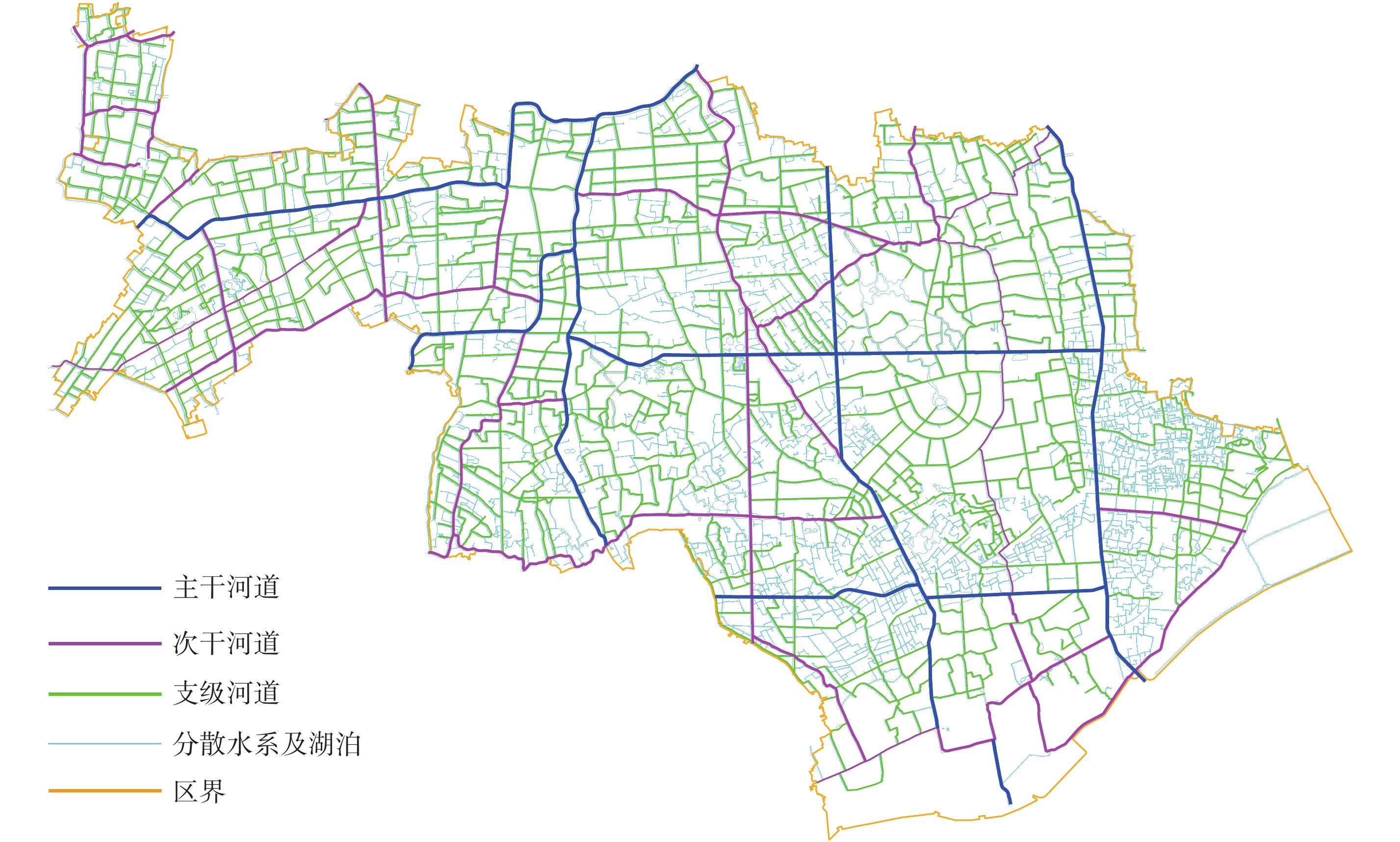
|
| 8 |
张敏, 罗军, 胡金磊, 等. 雷州市沿海风暴潮淹没危险性评估. 热带海洋学报, 2019, 38 (2): 1- 12.
|
| 9 |
刘秋兴, 李铖. 上游洪水对台风风暴潮过程期间长江口水位的影响研究. 海洋通报, 2017, 36 (2): 135- 142.
|
| 10 |
朱军政, 于普兵. 钱塘江河口杭州湾风暴潮溢流计算方法研究. 水科学进展, 2009, 20 (2): 269- 274.
doi: 10.3321/j.issn:1001-6791.2009.02.018
|
| 11 |
殷杰. 中国沿海台风风暴潮灾害风险评估研究 [D]. 上海: 华东师范大学, 2011.
|
| 12 |
叶明武. 沿海台风风暴潮灾害复合情景模拟与应急避难研究——以上海为例 [D]. 上海: 华东师范大学, 2011.
|
| 13 |
朱彦鋆. 基于一维二维水动力模型的上海台风风暴潮淹没情景模拟与暴露分析 [D]. 上海: 上海师范大学, 2018.
|
| 14 |
陈文想. 2008—2018年强台风对珠江口—横门及其上游的增水影响分析. 广东水利水电, 2019, (5): 28- 31.
|
| 15 |
陈长太, 祁继英. 基于SWOT的上海防洪除涝形势分析. 中国防汛抗旱, 2019, 29 (6): 19- 22.
|
| 16 |
季永兴, 刘水芹. 平原感潮地区雨型潮型组合对除涝规模的影响. 水利水电科技进展, 2017, 37 (5): 22- 27.
|
| 17 |
钱真, 谭琼, 贾卫红. 城市雨洪综合模拟方法及应用. 水利水电科技进展, 2015, 35 (6): 57- 61.
|
| 18 |
顾春林, 孙永清. 杭州湾金山卫岸段减灾对策浅述. 上海水利, 1990, (3): 51- 54.
|
| 19 |
闫白洋. 海平面上升叠加风暴潮影响下上海市社会经济脆弱性评价 [D]. 上海: 华东师范大学, 2016.
|
| 20 |
上海市城乡建设和交通委员会. 滩涂促淤圈围造地工程设计规范: DGTJ08-2111—2012 [S]. 上海: 上海市城乡建设和交通委员会, 2012.
|
| 21 |
上海市水务局. 2020年上海市河道(湖泊)报告 [R]. 上海: 上海市水务局, 2021.
|
| 22 |
上海市水务局. 上海市治涝标准: DB31T1121—2018 [S]. 上海: 上海市水务局, 2018.
|
| 23 |
上海东海海洋工程勘察设计研究院. 上海市海洋灾害风险评估与区划(金山区) [R]. 上海: 上海东海海洋工程勘察设计研究院, 2017.
|
| 24 |
国家海洋局. 风暴潮灾害风险评估和区划技术导则 [S]. 北京: 国家海洋局, 2015.
|
 ), 李路1,2, 贝竹园3, 王军3, 邱桔斐4, 章晓洁4
 中文核心期刊