华东师范大学学报(自然科学版) ›› 2021, Vol. 2021 ›› Issue (4): 134-144.doi: 10.3969/j.issn.1000-5641.2021.04.015

• 地理学 • 上一篇    

复Morlet小波方法遥感反演海浪波长和水深的仿真分析

程姗玲1, 朱首贤1,*(), 张瑰2, 张文静3   

  1. 1. 河海大学 海洋学院, 南京 210098
    2. 陆军工程大学 基础部, 南京 211101
    3. 国防科技大学 气象海洋学院, 南京 211101
  • 收稿日期:2020-07-15 出版日期:2021-07-25 发布日期:2021-07-23
  • 通讯作者: 朱首贤 E-mail:zhushouxian@vip.sina.com
  • 基金资助:
    国家自然科学基金(40906044, 41076048); 中央高校基本科研业务费项目(2018B46914)

Simulation analysis for remote sensing inversion of ocean wavelength and water depth by the Complex Morlet Wavelet method

Shanling CHENG1, Shouxian ZHU1,*(), Gui ZHANG2, Wenjing ZHANG3   

  1. 1. College of Oceanography, Hohai University, Nanjing 210098, China
    2. Department of Basic Engineering, Army University of Engineering, Nanjing 211101, China
    3. College of Meteorology and Oceanography, National University of Defense Technology, Nanjing 211101, China
  • Received:2020-07-15 Online:2021-07-25 Published:2021-07-23
  • Contact: Shouxian ZHU E-mail:zhushouxian@vip.sina.com

摘要:

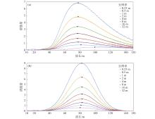
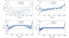
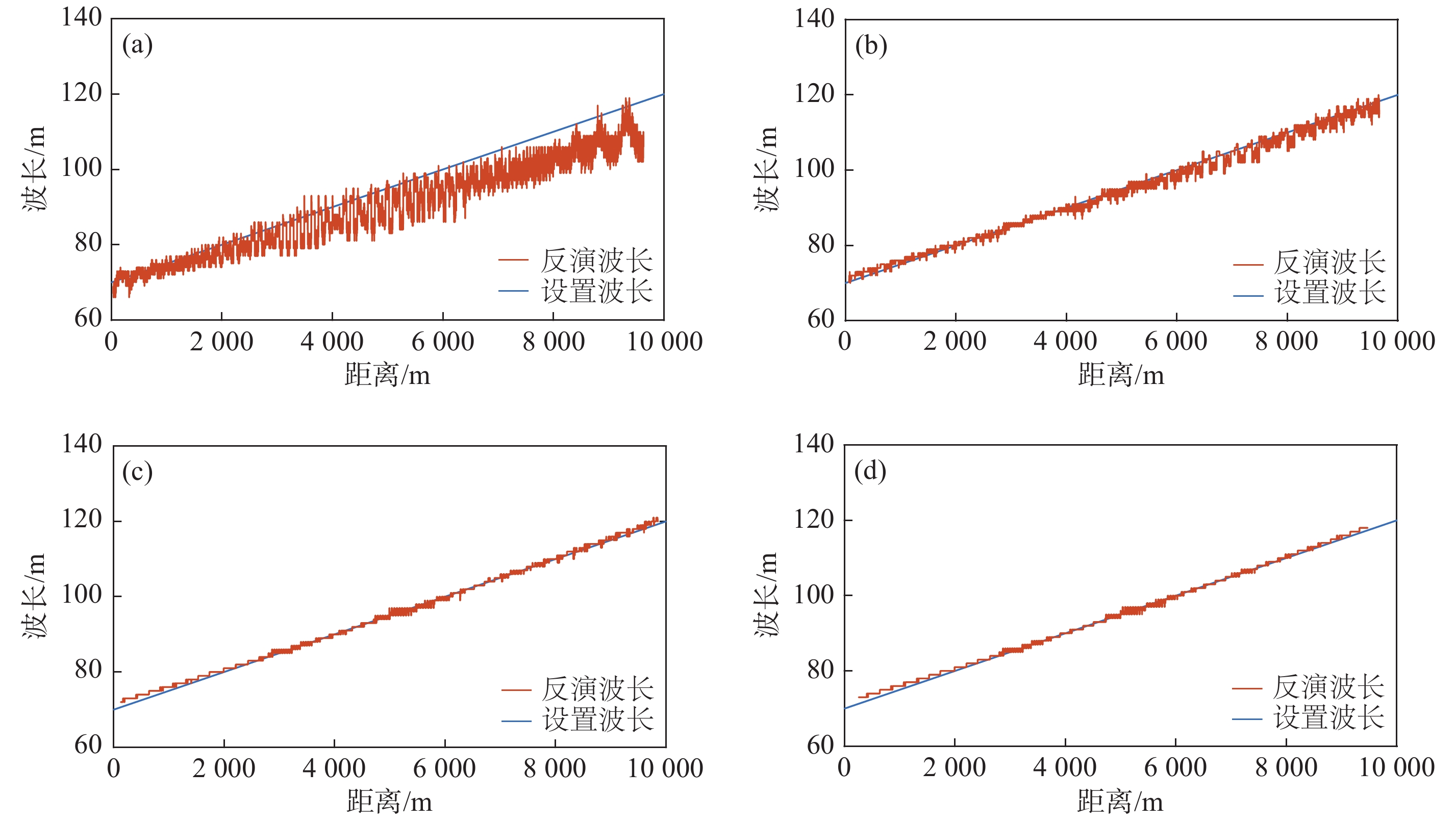
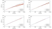
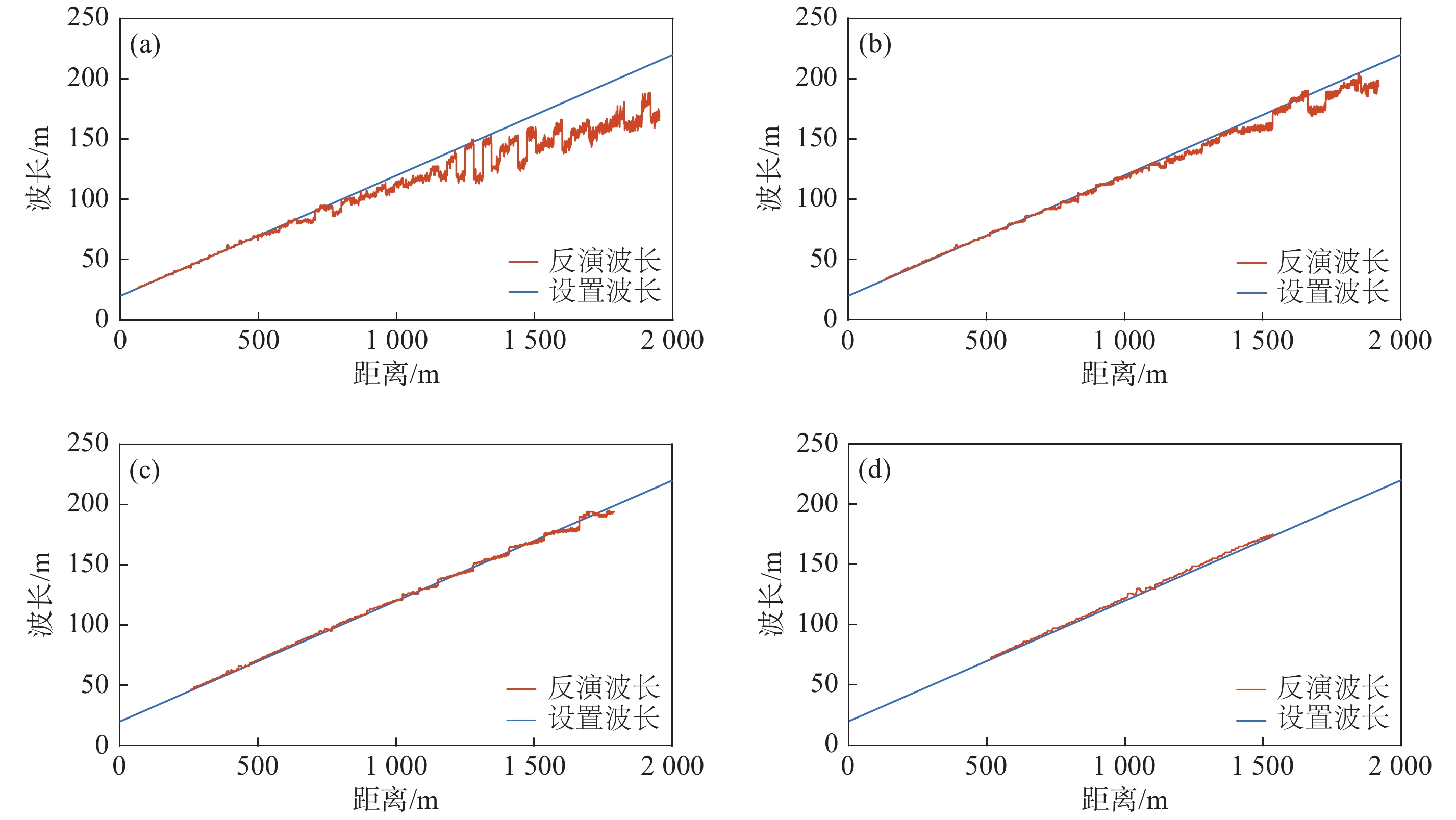
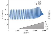
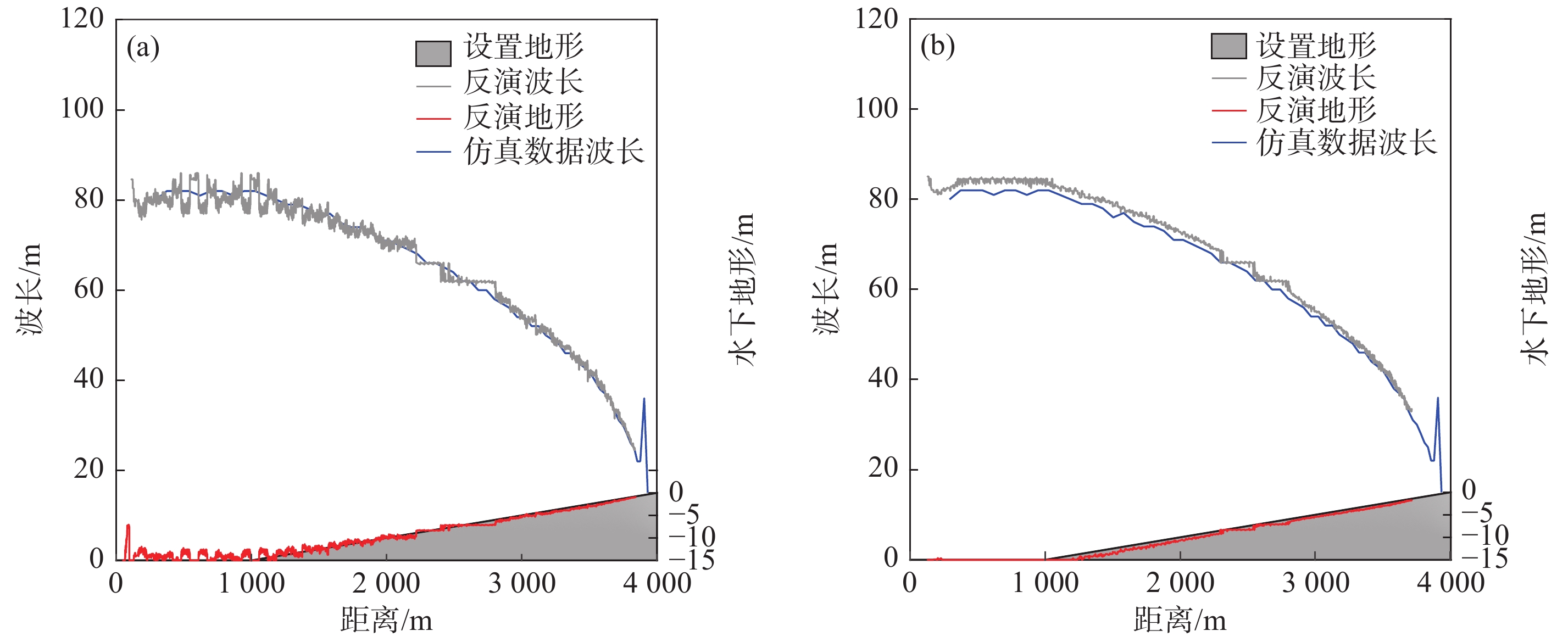
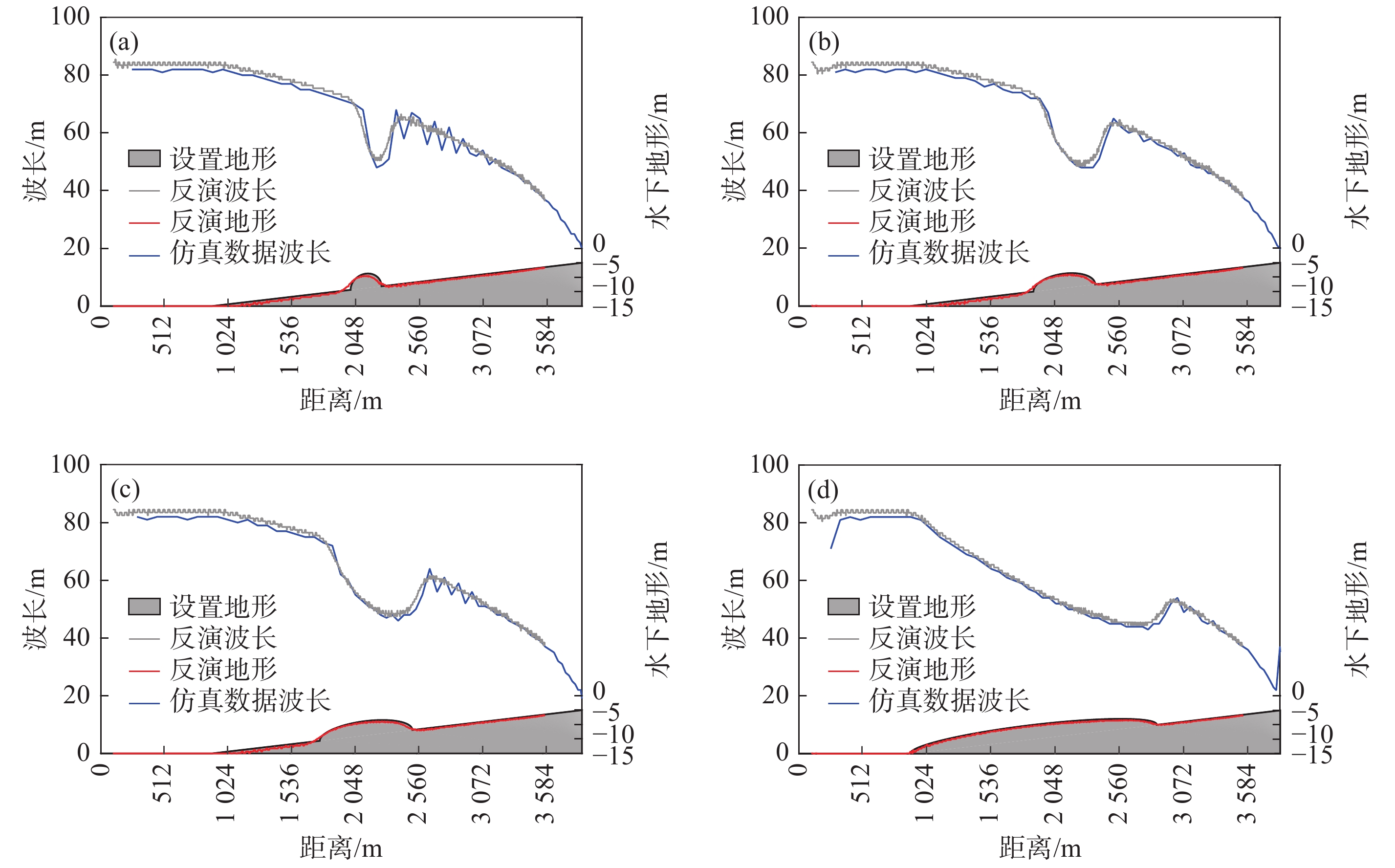
利用海浪造成的遥感影像波纹状特征, 可以基于小波方法反演海浪波长, 进而利用海浪波长随水深变浅而变短的特点反演浅海水深. 选择复Morlet小波方法, 采用理想波面数据和FUNWAVE模式数值模拟的波面数据代替遥感资料进行仿真研究, 讨论资料分辨率和子图分割对波长及水深反演的影响. 理想波面数据反演波长的结果表明, 在波长空间无变化的情况下, 子图长度大于波长、子图内均匀分布的资料点数在9个以上时, 资料分辨率对海浪波长反演结果基本无影响, 可以用波长能量谱解释其原因; 在波长空间变化的情况下, 子图长度大于2倍波长、每个波长内资料点数在4个以上, 可以得到较好的波长反演效果. 数值模拟波面数据反演波长对子图长度和资料点数也有类似的要求, 水深反演误差在子图尺度太大时略有增大, 随资料分辨率降低也略有增大.

关键词: 复Morlet小波, 海浪波长反演, 水深反演, 仿真分析

Abstract:

Using the wave-shaped features of remote sensing images, the wavelength of ocean waves can be determined based on the wavelet method. Shallow water depths can then be estimated from the wavelength because the wavelength becomes shorter as the water depth decreases. In this paper, remote sensing data were replaced by ideal elevation data, and numerical simulation data were used to study the performance of the Complex Morlet Wavelet method in estimating wavelength and water depth. In particular, the effects of data resolution and sub-image size on water depth estimation were explored. The results from the ideal elevation data shows that: when the wavelength has no spatial change and the size of the sub-image is greater than the wavelength, the data resolution has no substantial effect on the wavelength estimation if there are more than nine evenly distributed data grids in one image. This phenomenon can be explained by the wavelength-energy spectrum. When the wavelength changes spatially, accurate estimation of the wavelength requires that the sub-image size is larger than twice the wavelength and there are four data grids in one wavelength. The estimation of wavelength by numerical simulated data requires a similar size for sub-images and the data number. The error of water depth estimation increases slightly if the sub-image size is too large, and also increases slightly as the resolution of the data decreases.

Key words: Complex Morlet Wavelet method, wavelength inversion, water depth inversion, simulation analysis

中图分类号: